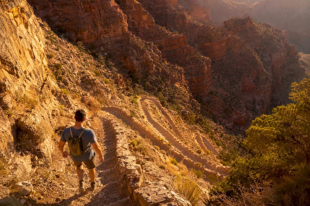
Yes, the Plateau Point hike is doable as a day trip, but only if you respect one rule above all others: the climb back out will cost you roughly twice the time and effort of the walk down. This is a demanding Bright Angel Trail route covering a round trip distance in the low 12-mile range with over 3,000 feet of net elevation change, and most fit hikers need a full day to complete it safely.
- Start before sunrise. For expert advice on timing and how to handle challenging mountain terrain, visit the Altai Mountains Resort heliski options. Midday heat in the inner canyon turns a manageable hike into an emergency.
- Confirm water status and trail conditions with the National Park Service the morning you go, not the week before.
- Carry enough water for the full trip even when resthouse taps are reported "on."
Pro Tip: Treat your turnaround time as a hard deadline, not a suggestion. Decide it before you leave the rim, and honor it even if Plateau Point is still a mile away.
Key Takeaways
The Plateau Point hike rewards fit, prepared hikers who treat the climb out as a harder, separate effort from the descent and start before sunrise to beat inner-canyon heat.
| Point | Details |
|---|---|
| Distance and elevation | Expect about 12 miles round trip with over 3,000 feet of net elevation change. |
| Plan the return, not the descent | Assume the climb out takes roughly twice as long as the way down to Plateau Point. |
| Start early, avoid midday heat | Begin before sunrise and stay off the trail between 10 a.m. and 4 p.m. in summer. |
| Water is never guaranteed | Check current NPS water status the morning of your hike, even at resthouses. |
| Consider a guided hike | Grand Canyon Journeys offers a WFR-guided, door-to-door option for hikers wanting built-in safety margin. |
Table of Contents
- Plateau Point Hike Quick Facts at a Glance
- Bright Angel to Plateau Point: The Route Step by Step
- How Long Does the Plateau Point Hike Take?
- Where Can You Get Water on the Trail?
- What Are the Biggest Hazards on This Hike?
- What Should You Pack for a Plateau Point Day Hike?
- Do You Need a Permit for Plateau Point?
- How Do You Check Current Trail Conditions?
- When Does a Guided Hike Make Sense?
- What Would an Experienced Guide Tell You Before You Go?
- Plan Your Plateau Point Hike With Grand Canyon Journeys
- Sources
Plateau Point Hike Quick Facts at a Glance
| Metric | Detail |
|---|---|
| Round trip distance | About 12 miles from Bright Angel Trailhead |
| Net elevation change | Roughly three thousand feet or more |
| Typical total time | A full day hike, depending on fitness and breaks |
| Trailhead | Bright Angel Trailhead, South Rim |
| Key mileposts | 1.5-Mile Resthouse, 3-Mile Resthouse, Havasupai Gardens, Tonto Trail junction, Plateau Point |
Water is normally available at the resthouses and at Havasupai Gardens, formerly known as Indian Garden, but none of that is guaranteed on any given day. The Plateau Point Trail itself, the final stretch across the Tonto Platform, has no shade and no water at all.
Bright Angel to Plateau Point: The Route Step by Step
The Bright Angel Trail drops fast through switchbacks below the trailhead, passing the 1.5-Mile Resthouse and then the 3-Mile Resthouse, both with seasonal water and shade. From there you descend Jacob's Ladder, a steep, exposed set of switchbacks cut through the Redwall Limestone that route data from onX flags as the toughest stretch of the return climb. The trail then follows Garden Creek down to Havasupai Gardens at mile 4.5, where you'll find reliable shade, a ranger station, and an emergency phone.
From Havasupai Gardens, the Plateau Point Trail splits off and crosses the flat, sun-baked Tonto Platform to the Tonto Trail junction before reaching the viewpoint itself, a final leg of less than a mile across exposed Tapeats sandstone with zero shade.
| Landmark | Distance from trailhead | Notes |
|---|---|---|
| 1.5-Mile Resthouse | 1.5 mi | Seasonal water, shade, restrooms |
| 3-Mile Resthouse | 3 mi | Seasonal water, shade, restrooms |
| Havasupai Gardens | 4.5 mi | Water, shade, ranger station, emergency phone |
| Tonto Trail junction | Just past Havasupai Gardens | Decision point for Plateau Point spur |
| Plateau Point | About 6 miles one way | No water, no shade, mule corral nearby |
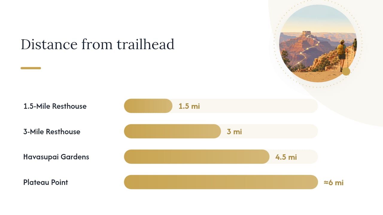
Havasupai Gardens is your natural bail-out point. If you're behind schedule or feeling the heat by the time you reach it, turning around here still gives you a solid day hike without the added exposure of the Tonto Platform.
Pro Tip: When you hear mule bells or a wrangler's call, step to the inside of the trail away from the edge and stay put until the whole train passes. Mule handlers have the right of way, and arguing that point with a thousand-pound animal never goes well.
How Long Does the Plateau Point Hike Take?
Budget a full day, leaning toward the longer end if you're not used to high-desert elevation or steep, sustained climbing. Fitness, break frequency, and how long you linger at the viewpoint all shift that window, but the descent to Plateau Point rarely takes more than half the day.
The pacing rule that matters most: whatever time your descent to Havasupai Gardens and Plateau Point takes, plan on doubling it for the return. The National Park Service notes that underestimating this climb is the single most common mistake hikers make on Bright Angel, because the descent feels deceptively easy right up until the ascent begins.
Start at first light. The NPS advises against hiking between 10 a.m. and 4 p.m. in summer, when inner-canyon temperatures climb roughly 5.5°F for every 1,000 feet you descend below the rim. That delta means a mild 75°F morning at the trailhead can feel closer to 100°F down near Havasupai Gardens by early afternoon.
- Build in a fixed turnaround time before you leave, and treat it as non-negotiable.
- Add extra minutes for Jacob's Ladder on the way back. It's steeper and slower going up than it felt coming down.
Pro Tip: Set a phone alarm for your turnaround time rather than trusting yourself to notice the clock. Fatigue and heat both erode judgment faster than most hikers expect.
Where Can You Get Water on the Trail?
Water is normally available at the 1.5-Mile Resthouse, the 3-Mile Resthouse, and Havasupai Gardens, with additional access at the Bright Angel Trailhead itself. None of these sources are guaranteed. The NPS posts current water-status and trail-closure notices that can change with little warning, including seasonal shutoffs and maintenance outages.
- Carry at least 2 to 3 liters per person for the inner-canyon legs, more in summer heat.
- Bring a way to treat backup water (filter or tablets) in case a resthouse tap is off.
- Check the park's water-status page the morning of your hike, not days in advance.
Pro Tip: Top off completely at Havasupai Gardens before starting the Plateau Point spur. There's no water anywhere on the Tonto Platform, and that exposed stretch is where dehydration sneaks up fastest.
What Are the Biggest Hazards on This Hike?
Heat tops the list. Descending into the canyon can mean temperatures 20 to 30°F warmer than the rim in summer, and that gap alone sends more hikers into trouble than any other single factor. Avoid the trail between 10 a.m. and 4 p.m. during the hot months, and watch for headache, nausea, or stopped sweating as early warning signs of heat illness.
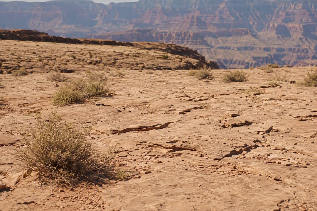
Flash floods and rockfall are less common but real, especially during monsoon season. If clouds build fast or you hear thunder, move away from narrow drainages and wait it out in a stable, open spot.
Mule trains use this trail daily, and NPS courtesy guidance requires hikers to yield the inside position and follow the wrangler's instructions. Watch your footing around mule droppings, which can make already-loose sections slicker.
The return climb itself is the hazard hikers plan for least. A long, steep ascent after a full day of heat and exertion strains the body in ways the descent never hints at, and lingering too long at Plateau Point before starting back is a common, avoidable error.
- Ration sodium-rich snacks throughout the day, not just at the end, to help prevent cramping on the climb.
- Begin your return before you feel tired, not after.
Pro Tip: Set a strict limit on how long you stay at the viewpoint, even though it's worth savoring. The exposed platform offers no shade at all, and every extra minute there is a minute of hydration you'll need for the climb back.
What Should You Pack for a Plateau Point Day Hike?
Pack light but don't skip the essentials. This is not a trail where you can improvise midway.
- 2 to 3 liters of water minimum, plus electrolyte mix and high-calorie, salty snacks
- Wide-brim sun hat, high-SPF sunscreen, and sunglasses
- Lightweight long-sleeve layer for sun protection, even in summer
- Trekking poles to ease the impact on the steep return climb
- Emergency whistle and a basic first-aid kit
- Map or GPS app, and a fully charged phone; note emergency phone locations at Havasupai Gardens
Footwear matters more than most gear on this list. Broken-in trail shoes or boots with real tread beat brand-new footwear every time, since blisters mid-descent can turn a long day into a miserable one.
Pro Tip: Pack one lightweight emergency layer even on a hot day. Afternoon storms and shaded stretches can drop the temperature fast, and a $20 shell weighs almost nothing in your pack.
Do You Need a Permit for Plateau Point?
A day hike to Plateau Point requires no permit. Camping below the rim does, and that permit runs through Recreation, where you submit an itinerary in advance.
- Consider converting to an overnight if you want to split the mileage, reduce heat exposure, or build in a bigger safety margin.
- Havasupai Gardens has designated backcountry campsites with water access, making it a practical midpoint for an overnight stay.
- Pack out everything you bring in, and follow Leave No Trace principles at every campsite.
How Do You Check Current Trail Conditions?
Check the NPS trail-closures and key-messages page for the latest on the corridor trails before you commit to a start time. Closures happen for reasons ranging from Transcanyon Waterline maintenance to rockfall or fire impacts, and they can shift on short notice.
- Review the Grand Canyon Village and Phantom Ranch weather forecast the night before and again at sunrise.
- Cross-check recent hiker reports on community platforms for firsthand notes on trail surface, mule activity, or water at the resthouses.
Pro Tip: Bookmark the NPS status page on your phone so you can reload it at the trailhead, where cell service is often your last reliable connection for hours.
When Does a Guided Hike Make Sense?
A private guided hike removes most of the guesswork this article just walked you through. Grand Canyon Journeys pairs hikers with Wilderness First Responder certified guides who manage pacing, water planning, and turnaround decisions in real time, rather than leaving those calls to a tired hiker at hour nine.
Expect door-to-door pickup, a guide who already knows where the resthouse taps stand and where the mule trains run that day, and the option to add extras like a catered lunch. This fits hikers who want a genuine safety margin, visitors on a tight schedule who can't afford a permit application timeline, or anyone who would rather hike than manage logistics.
Pro Tip: If guaranteeing a water and contingency plan matters more to you than doing the permit paperwork yourself, a guided day hike solves both problems at once.
What Would an Experienced Guide Tell You Before You Go?
Every experienced guide treats this route as two separate jobs: a controlled, joint-friendly descent and a deliberately slower, food-and-sodium-managed climb back out. Set a conservative turnaround time, respect whatever the current water and closure notices say that morning, and don't let the view from Plateau Point talk you into fifteen more minutes than you planned.
Plan Your Plateau Point Hike With Grand Canyon Journeys
Planning this hike solo means juggling permit rules, shifting water notices, and a return climb that punishes bad timing. Grand Canyon Journeys offers a different route to the same summit views: a private, door-to-door guided hike where a Wilderness First Responder certified guide handles the pacing, the water math, and the turnaround call while you focus on the canyon in front of you.
Our private Grand Canyon hiking tour below the rim is built for exactly the reader who just read this entire guide and thought about how much could go wrong on a solo attempt. You get a climate-controlled vehicle from Sedona, an experienced guide who already knows today's conditions, and the option to add a rim-side lunch at El Tovar once you're back on solid ground. If a supported, safer version of this hike sounds better than managing it all yourself, check available dates for a private Grand Canyon day tour from Sedona and start there.
Sources
- Bright Angel Trail (National Park Service)
- Bright Angel to Plateau Point | Hiking Trail Maps, Difficulty, Trail Status | onX
- Bright Angel Trail (official trail PDF, NPS)