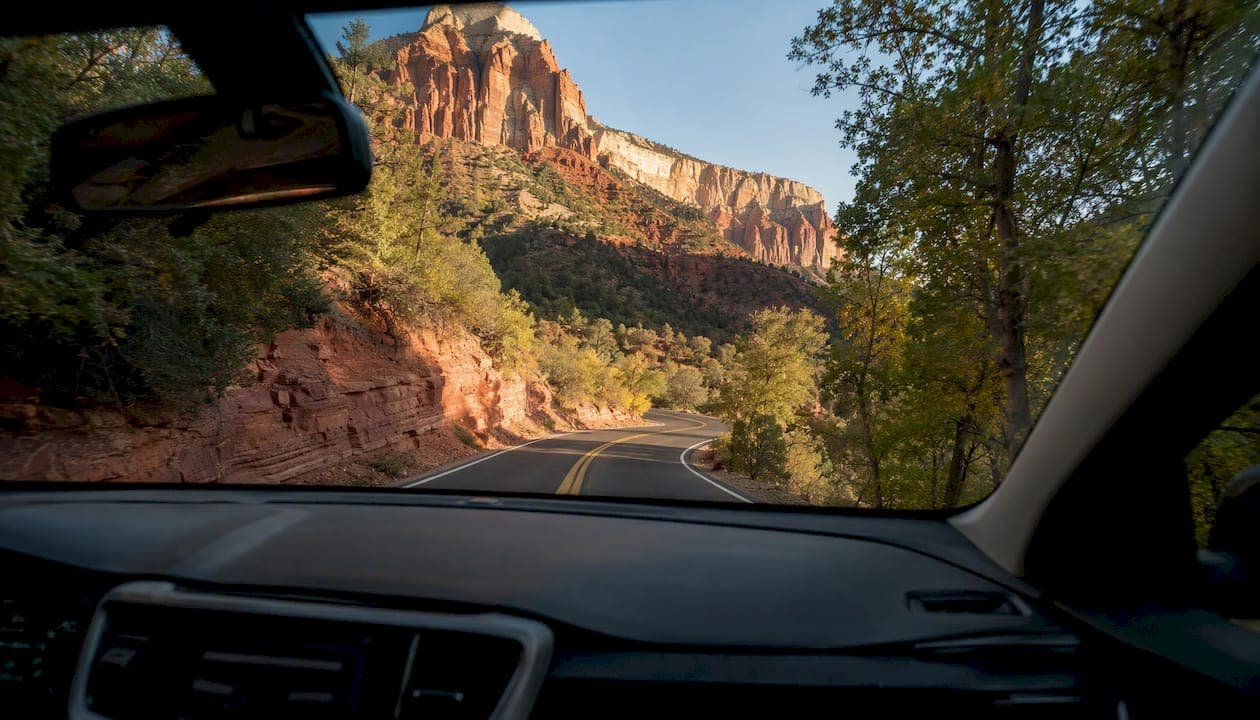
Sedona's best scenic drives break down cleanly by what you're after. The Red Rock Scenic Byway (SR 179) is the go-to for first-timers and photographers chasing red-rock panoramas with minimal driving effort. Oak Creek Canyon (SR 89A) is the right call for anyone who wants a full canyon experience with elevation drama and swimming holes. Red Rock Loop Road is the quieter alternative when SR 179 is packed. Schnebly Hill Road delivers raw, elevated desert views, but only if you have the right vehicle. Airport Mesa Loop is a quick 20-minute add-on for a 360-degree Sedona skyline.
Here's the fast shortlist:
- Red Rock Scenic Byway (SR 179) — Best for first-timers, photographers, and families. Paved, short, and loaded with pullouts.
- Oak Creek Canyon (SR 89A / highway 89A scenic drive) — Best for full-day explorers and anyone driving the Sedona to Flagstaff scenic route. Paved, dramatic, and includes Slide Rock.
- Red Rock Loop Road — Best for a quieter Cathedral Rock photo run. Paved, low-traffic, and underrated.
- Schnebly Hill Road — Best for 4x4 drivers and off-road enthusiasts. Unpaved, rough, and worth it for the views.
- Airport Mesa Loop — Best for a fast sunset or overview stop. Short, paved, and easy to add to any itinerary.
For route-by-route planning details, read straight through. If you'd rather skip the logistics and let someone else handle parking, timing, and local context, the private tour section near the end also covers that option.
Key Takeaways
The most effective way to experience Sedona's scenic drives is to go early, match your vehicle to the road, and treat each route as a half-day or full-day destination rather than a quick pass-through.
| Point | Details |
|---|---|
| Best timing window | Drive before 9:00 AM or after 4:00 PM to avoid peak crowds and secure parking. |
| SR 179 essentials | 7.5 miles, paved, all vehicles; allow 2–4 hours with stops at Bell Rock and Chapel of the Holy Cross. |
| SR 89A canyon drive | ~15–16 miles, 2,200-foot elevation gain; check road conditions in winter before driving the switchbacks. |
| Red Rock Pass rule | Required at trailhead parking areas only; not needed for casual driving or brief overlook stops. |
| Grandcanyonjourneys option | Private Sedona tours include door-to-door pickup, local guides, and all park logistics for a fully handled experience. |
Table of Contents
- What makes Sedona scenic drives worth planning carefully?
- How do you avoid crowds and plan a Sedona drive well?
- Sample itineraries for every schedule
- When does a private guided tour make more sense than self-driving?
- What I'd tell a friend planning their first Sedona drive
- Skip the logistics: private Sedona tours from Grandcanyonjourneys
- Sources
What makes Sedona scenic drives worth planning carefully?
Red Rock Scenic Byway (SR 179): route facts and planning notes
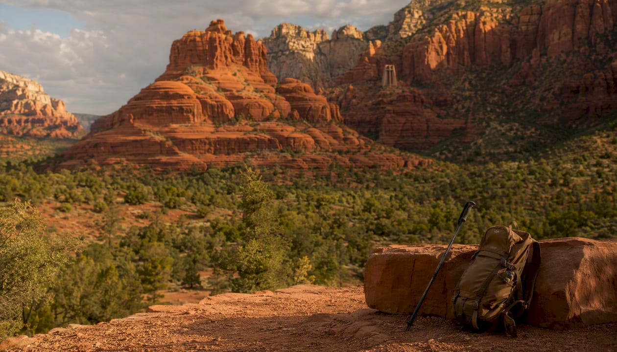
The Red Rock Scenic Byway is 7.5 miles long and designated an All-American Road, the highest federal scenic designation in the country. You can drive it end-to-end in about 20 minutes, but that's not the point. Allow several hours if you plan to stop at pullouts, do a short hike, or visit the Chapel of the Holy Cross. The road runs from the Village of Oak Creek north into Sedona, entirely paved and suitable for any standard vehicle.
| Route fact | Details |
|---|---|
| Length | 7.5 miles (one way) |
| Drive time (no stops) | ~20 minutes |
| Recommended time | 2–4 hours with stops |
| Road surface | Paved |
| Vehicle suitability | All standard vehicles |
| Red Rock Pass | Required at trailhead parking areas |
| Difficulty | Easy |
The standout stops along SR 179:
- Bell Rock — One of Sedona's most photographed formations. A short, well-marked trail loops around the base. The bell rock viewpoint parking area fills by 8:30 AM on weekends.
- Courthouse Butte — Directly adjacent to Bell Rock. The combined loop trail (4.3 miles) is flat and accessible for most fitness levels.
- Chapel of the Holy Cross — Built into the red rock face, this is one of the most striking architectural viewpoints in Arizona. Parking is limited; arrive before 9:00 AM or after 4:00 PM.
- Airport Mesa — A short detour off SR 179 with a 360-degree view of the Sedona basin. The best vantage point for sunset in the area.
Pro Tip: Shoot Bell Rock from the east side of the parking area in the morning. The formation catches direct light before 10:00 AM, and the shadow contrast against the red sandstone is sharper than anything you'll get at midday.
The Red Rock Pass is required when you leave your vehicle at designated trailhead parking areas. It does not apply to casual driving or brief roadside stops at major overlooks. Day passes are available at self-serve kiosks at most trailheads. For navigation and gateway directions from Phoenix or Flagstaff, the recreation.gov visitor guide has practical starting-point info.
Oak Creek Canyon scenic drive (SR 89A): what to expect and must-see stops
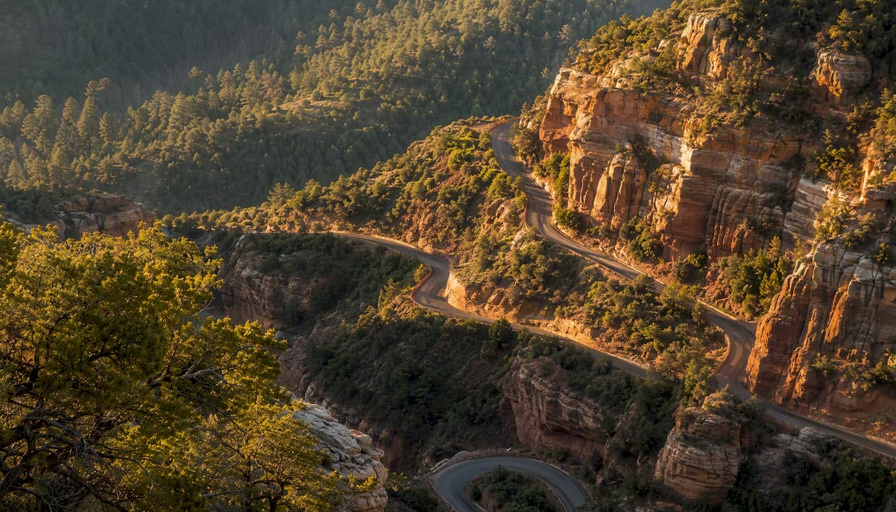
The Oak Creek Canyon drive runs roughly 15–16 miles between Sedona and Flagstaff, climbing approximately 2,200 feet through one of the most dramatic canyon corridors in the Southwest. This is the highway 89A scenic drive that most people mean when they talk about the Sedona to Flagstaff scenic drive. The road is entirely paved and handles standard vehicles fine in good weather, but conditions at higher elevations can shift fast, especially in winter.
| Route fact | Details |
|---|---|
| Length | ~15–16 miles (one way) |
| Elevation gain | ~2,200 feet |
| Drive time (no stops) | about 45 minutes one way |
| Round-trip with stops | ~90 minutes to half-day |
| Road surface | Paved |
| Vehicle suitability | Standard vehicles (check conditions in winter) |
| Red Rock Pass | Required at trailhead parking |
Arizona Highways notes the canyon qualifies as a National Scenic Byway and that a round-trip drive without extended stops takes about 90 minutes. The switchbacks near the northern end, around the 14-mile mark, are where drivers need to pay attention, especially if passengers are prone to motion sickness. Descending from Flagstaff puts the canyon-wall views on the passenger side, which many visitors prefer.
Key stops along SR 89A:
- Midgley Bridge — A steel arch bridge over Wilson Canyon, about 2 miles north of Sedona. Pull off on the south side for a view down into the canyon. Free to stop; no pass required for a brief visit.
- Slide Rock State Park — The most popular swimming hole in Arizona. Natural water slides carved into the red rock creek bed. Day-use fees apply, and the park fills early on summer weekends. Arrive before 9:00 AM or expect a wait.
- Oak Creek Vista Overlook — Near the top of the canyon, this U.S. Forest Service pullout offers a sweeping view back down into the canyon. No fee for a brief stop; a Red Rock Pass is required if you park and hike.
- West Fork Trailhead — One of the most scenic canyon hikes in Arizona, following a creek through towering red walls. Trailhead parking fills by mid-morning in peak season.
Safety note: SR 89A is paved and well-maintained, but the switchbacks near the Flagstaff end demand full attention. Avoid passing on curves, keep headlights on in the canyon, and check the Coconino National Forest road conditions before driving in winter or after heavy rain.
Schnebly Hill Road and rough-terrain options: what you need to know
Schnebly Hill Road is the most dramatic unpaved drive near Sedona, climbing out of the red rock basin to a series of elevated overlooks with views that rival anything you'll see from a paved pullout. The tradeoff is the road itself: washboard dirt, loose rock, and sections that drop off without guardrails.
What to know before you go:
- Surface: Unpaved, rough, and rutted in sections. High clearance is required; 4WD is strongly recommended.
- Length: Roughly 12 miles from Sedona to the Schnebly Hill Vista area.
- Seasonal closures: The road can close after heavy rain or winter snow. No reliable cell service for most of the route.
- Services: None. No gas, no restrooms, no assistance if you get stuck.
- Timing: Best driven in dry conditions, late spring through early fall.
Standard sedans and low-clearance vehicles should not attempt Schnebly Hill Road. Period. The road has claimed more than a few rental cars, and most rental agreements prohibit off-road driving, which means you're on your own if something goes wrong.
Pro Tip: If you want those elevated canyon views without the vehicle risk, a private guided off-road tour is the cleaner solution. Guides use purpose-built vehicles, know which sections are passable after recent weather, and handle the logistics so you can focus on the scenery. Grandcanyonjourneys offers private Sedona sightseeing tours that include curated viewpoints without the off-road gamble.
For visitors without a suitable vehicle, the Airport Mesa overlook and the Chapel of the Holy Cross viewpoint on SR 179 both deliver elevated red-rock perspectives from paved roads. Neither requires anything beyond a standard car.
The best pullouts and what to do at each one
Every Sedona scenic drive worth doing has at least two or three stops that justify slowing down. Here's what each major pullout actually offers:
- Bell Rock Viewpoint (SR 179): The most photographed formation in Sedona. Walk the base trail (30–60 minutes), or just shoot from the parking area. Restrooms on-site. Red Rock Pass required for parking.
- Courthouse Butte (SR 179): Combine with Bell Rock for a 4.3-mile loop. Flat, accessible, and less crowded than the Bell Rock trailhead. Allow 1.5–2 hours for the full loop.
- Chapel of the Holy Cross (SR 179): Drive up to the chapel, walk the short path to the entrance, and look back at the valley. No fee to visit the chapel itself. Parking is tight; 15–20 minutes is enough for most visitors.
- Midgley Bridge (SR 89A): A 5-minute stop with a strong photo payoff. The bridge frames Wilson Canyon below. No pass required for a brief roadside stop.
- Oak Creek Vista Overlook (SR 89A): Near the canyon rim, this U.S. Forest Service pullout gives you the full canyon panorama. Free for a brief stop. Picnic tables available.
- Slide Rock State Park (SR 89A): Budget 2–3 hours if you plan to swim. Bring water shoes; the creek rocks are slippery. Day-use fees apply. Restrooms and a small gift shop on-site.
Accessibility varies. Bell Rock and Courthouse Butte trails are relatively flat and manageable for most mobility levels. The Chapel of the Holy Cross has a paved path from the parking area. Slide Rock involves uneven creek rocks and is not suitable for visitors with significant mobility limitations.
How do you avoid crowds and plan a Sedona drive well?
The single biggest mistake Sedona visitors make is arriving at 10:00 AM and wondering why every parking lot is full. Peak-season congestion on SR 179 and SR 89A fills parking early, and the mid-morning to mid-afternoon window is when both roads are at their worst.
Best windows to drive:
- Before 9:00 AM: Parking is available, light is better for photography, and the formations cast long shadows that add depth to photos.
- After 4:00 PM: Crowds thin, golden hour begins around 5:30–6:30 PM depending on season, and sunset from Airport Mesa or Bell Rock is worth the wait.
Seasonal notes:
- Fall (October–November): Oak Creek Canyon turns gold and amber. The canyon drive is at its most photogenic, but also its most crowded on weekends.
- Winter (December–February): Snow occasionally dusts the red rocks, which is stunning. SR 89A switchbacks can ice over; check road conditions before driving.
- Spring (March–May): Wildflowers along the creek. Comfortable temperatures. Busy but manageable on weekdays.
- Summer (June–August): Hot. Very hot. Drive early, carry more water than you think you need, and avoid midday hikes.
Packing checklist:
- At least 1 liter of water per person per hour of activity
- Sunscreen and a hat (shade is scarce at most pullouts)
- Layers for Oak Creek Canyon (temperature drops noticeably in the canyon)
- Offline maps downloaded before you leave (cell coverage is unreliable on Schnebly Hill Road and spotty in the canyon)
- A portable charger for your phone
- Cash or a credit card for Red Rock Pass kiosks and Slide Rock fees
Parking strategy: The Red Rock Pass is required at trailhead parking areas, not for casual driving or brief overlook stops. Buy a day pass at the trailhead kiosk or in advance. If a lot is full, do not park on the road shoulder in a no-parking zone. Fines are real and rangers patrol actively. The shuttle system operating in peak season connects several SR 179 trailheads and is worth using when lots are full.
Sample itineraries for every schedule
1-hour quick drive: SR 179 highlights
Start at the Bell Rock Viewpoint parking area. Walk the base trail for 20 minutes, then drive north to the Chapel of the Holy Cross (15-minute stop). Finish at the Airport Mesa overlook for a view over the whole basin. Total drive time: under 30 minutes. Total experience: about 1 hour.
Half-day loop: Oak Creek Canyon and Slide Rock
Leave Sedona by 8:00 AM. Drive SR 89A north, stopping at Midgley Bridge (5 minutes) and then Slide Rock State Park (1.5–2 hours). Continue to Oak Creek Vista Overlook (15 minutes), then return to Sedona. Back by noon, before the afternoon crowds hit the canyon.
Full-day exploration: combined loop with hikes
Morning: SR 179 south, Bell Rock and Courthouse Butte loop (2 hours). Midday: drive to West Fork Trailhead on SR 89A for a canyon hike (2–3 hours). Afternoon: Oak Creek Vista Overlook, then back through Sedona for a sunset stop at Airport Mesa. For a guided version of this kind of day, the Sedona Highlights & Hike Tour from Grandcanyonjourneys covers the key stops with a local guide handling all the logistics.
Sunset photography run
Arrive at Airport Mesa by 5:00 PM. Shoot the basin as the light warms. Drive south on SR 179 to Bell Rock for the last 20 minutes of direct light. The east face of Bell Rock holds color longest. Allow 90 minutes total.
Pro Tip: Cathedral Rock reflections appear in Oak Creek at Red Rock Crossing, about 1 mile off Red Rock Loop Road. The reflection shot requires calm water, which is most reliable in early morning before the wind picks up. Get there by 7:00 AM for the best conditions.
When does a private guided tour make more sense than self-driving?
Self-driving Sedona is genuinely rewarding, but there are situations where handing the wheel to a local guide is the smarter call.
A private guided tour makes sense when:
- Parking is the obstacle. A guide with a permitted vehicle sidesteps the trailhead lottery entirely.
- You have limited time. A local guide sequences stops for the best light and shortest travel between them. No wrong turns, no wasted time circling full lots.
- Mobility or comfort is a factor. Door-to-door pickup in a climate-controlled vehicle with a guide who knows accessible routes changes the experience for travelers who find self-driving stressful.
- You want local context. The geology, the history of the formations, the best-kept photo angles — a guide who drives these roads daily knows things no map app will tell you.
- You're combining driving with hiking. A private Sedona sightseeing and hike tour lets you do a guided trail below the red rocks without worrying about trailhead parking or route-finding.
Grandcanyonjourneys runs private Sedona tours from its Sedona base, with door-to-door pickup, luxury vehicles, and guides who handle all the logistics including park passes and timing. For travelers who want the views without the planning friction, it's one concrete alternative to self-driving. For those who want to extend the day further, the private Grand Canyon day tour pairs naturally with a Sedona morning.
For travelers who want a broader framework for planning a private guided trip, bespoke itinerary planning resources can help structure multi-day Northern Arizona visits around your specific priorities.
What I'd tell a friend planning their first Sedona drive
Most Sedona visitors spend their best light hours stuck in traffic on SR 179, then wonder why the photos look flat. The drives themselves are not the problem. The timing is.
The pullout that consistently surprises people is Oak Creek Vista Overlook at the top of the canyon. It's a U.S. Forest Service stop with no fee for a brief visit, no Instagram crowd, and a view that looks straight down 2,200 feet of canyon. Most visitors blow past it because they're focused on Slide Rock. That's a mistake worth correcting.
One more thing: the canyon temperature on SR 89A drops noticeably compared to Sedona proper, sometimes by 10–15 degrees. If you're driving up from Sedona in shorts and a t-shirt, pack a layer. The switchbacks near Flagstaff sit at significantly higher elevation, and the wind at Oak Creek Vista can be sharp even in May.
Skip the logistics: private Sedona tours from Grandcanyonjourneys
Sedona's parking situation alone is enough to derail a well-planned day. Grandcanyonjourneys removes that friction entirely, with door-to-door pickup from your Sedona hotel, a private luxury vehicle, and a local guide who has already solved the timing and parking puzzle for you.
What's included in a private Sedona tour:
- Door-to-door pickup and drop-off in a climate-controlled luxury vehicle
- A local guide who sequences stops for the best light and least congestion
- All park logistics and pass fees handled
- Flexible itinerary, including optional guided hikes at key red rock formations
- Private group only — no shared buses, no strangers
The Sedona Highlights Tour covers the essential red rock viewpoints in a half-day format. For travelers who want to add a guided hike, the Sedona Highlights & Hike Tour pairs the drive with a trail below the formations. Check availability and book your date directly at Grandcanyonjourneys.
Sources
Before you drive, check current conditions from the sources that actually update them:
- Red Rock Scenic Byway | America's Byways
- Oak Creek Canyon Scenic Drive
- Oak Creek Canyon | Arizona Highways
- Recreation