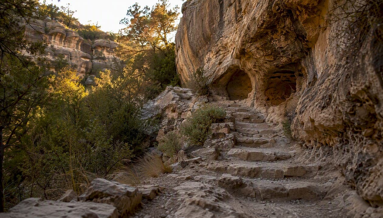
The Walnut Canyon Island Trail is a strenuous 0.9–1.0 mile round-trip loop that descends roughly 185 vertical feet into Walnut Canyon, passing 25 Sinagua cliff-dwelling rooms along the way. Plan for about an hour, wear sturdy shoes, and know that entry closes in the late afternoon, well before the park itself shuts down, well before the park itself shuts down. Fit hikers acclimated to approximately 6,700 feet of elevation will find it deeply rewarding. Anyone with mobility challenges, young children in carriers, or limited time should consider the Rim Trail instead.
Key Takeaways
The Island Trail at Walnut Canyon is a short but genuinely strenuous hike that rewards fit, acclimated visitors with some of the most accessible Sinagua cliff dwellings in the American Southwest.
| Point | Details |
|---|---|
| Distance and time | ~0.9–1.0 mile round-trip; plan for about an hour plus time at dwellings |
| Entry cutoff | Island Trail entry closes at 4:00 p.m. daily; arrive well before this |
| Essential kit | At least 1 liter of water per person, sturdy shoes, sun protection, light layers |
| Rim Trail alternative | Choose the 0.7-mile Rim Trail if mobility, time, or fitness is a concern |
| Grandcanyonjourneys option | Private guided tours from Sedona can include Walnut Canyon and other archaeological monuments with door-to-door logistics |
Table of Contents
- What are the key facts about the Walnut Canyon Island Trail?
- What will you see and experience on the Island Trail?
- How do you get to the Island Trailhead from Flagstaff?
- What are the park hours, fees, and access rules?
- What should you bring, and what safety risks should you know?
- Who were the Sinagua, and why does this site matter?
- Rim Trail vs. Island Trail: which one is right for you?
- How should you behave on the trail to protect the site?
- Where to check conditions before your visit
- Why the Island Trail belongs on every Northern Arizona itinerary
- Private guided tours that include archaeological monuments
- Authoritative links for trip planning
- Sources
What are the key facts about the Walnut Canyon Island Trail?
| Detail | Info |
|---|---|
| Distance (round-trip) | ~0.9–1.0 mile (NPS); AllTrails lists ~0.8 miles |
| Typical time | about an hour |
| Difficulty | Strenuous |
| Elevation change | ~185 ft descent (and return ascent) |
| Approximate steps | ~240 concrete steps (Grand Canyon Trust); counts vary by source |
| Trailhead elevation | ~6,690 ft |
| Island Trail entry closes | in the late afternoon daily |
| Pets | Not allowed on Island Trail |
| Accessibility | Paved but not wheelchair accessible (steep stairs) |
| Entrance fee | Required; check NPS fees page for current rates |
A few things to act on before you arrive:
- Start by 9:00–10:00 a.m. in summer to beat afternoon monsoon thunderstorms and midday heat.
- Dogs are prohibited on the Island Trail; leave them at the trailhead or plan accordingly.
- The 4:00 p.m. entry cutoff is strictly enforced by rangers for hiker safety.
What will you see and experience on the Island Trail?
The trail begins at the visitor center and drops immediately. Within the first few hundred feet, you're descending concrete stairs into the canyon, the walls closing in and the temperature dropping a few degrees. The route loops around a limestone butte, the "island," with the canyon floor visible far below and cliff-dwelling alcoves appearing at eye level as you round each bend.
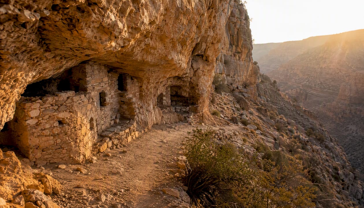
Grand Canyon Trust documents passage by roughly 25 cliff-dwelling rooms built directly into the canyon walls. Some alcoves are close enough to see the original mud mortar between stones. Interpretive signs along the route explain Sinagua daily life, construction techniques, and the canyon's ecology. The visitor center also screens a short film before you descend, which is worth 15 minutes of your time.
The loop can be walked in either direction. Most hikers go counterclockwise, which puts the steepest stair sections early in the descent. The return climb is where the altitude makes itself known, so pace yourself on the way up.
Pro Tip: Pause at the first major overlook before committing to the full descent. The view across the canyon gives you a sense of scale that the trail itself, tucked under the rim, doesn't always provide.
How do you get to the Island Trailhead from Flagstaff?
The monument sits about 7.5 miles east of downtown Flagstaff, an easy 15-minute drive.
From downtown Flagstaff:
- Head east on Historic Route 66 / I-40 Business.
- Merge onto I-40 East.
- Take Exit 204 (Walnut Canyon Road).
- Turn right (south) onto Walnut Canyon Road.
- Drive 3 miles to the monument entrance and visitor center.
From I-40 westbound: Take Exit 204, turn left (south) onto Walnut Canyon Road, then follow 3 miles to the entrance.
The visitor center sits at the top of the canyon. The Island Trailhead is accessed through the visitor center porch, so you pass through the building to pick up your permit/entry stamp and watch the orientation film before descending. Parking is in the lot adjacent to the visitor center.
- Parking fills quickly on summer weekends and holiday weekends. Arrive before 9:30 a.m. to secure a spot.
- There is no overflow lot; if the main lot is full, you may need to wait for a space.
- Combining the visit with a stop at Wupatki National Monument (about 30 miles north) makes for a full archaeological day.
What are the park hours, fees, and access rules?
The NPS plan-your-visit page lists standard park hours as 9:00 a.m. to 5:00 p.m. The trails operate on tighter windows including an enforced cutoff for Island Trail entry well before park closing time.
- Rim Trail entry: 9:00 a.m. to 4:30 p.m.
- Holiday and winter hours may differ; check NPS alerts before traveling.
The Island Trail entry cutoff exists specifically so hikers can complete the strenuous ascent before the monument closes. Rangers enforce it as a safety measure, not a suggestion.
Key access rules:
- No pets on the Island Trail (or anywhere in the monument).
- No touching, leaning on, or climbing cliff-dwelling walls.
- No drones.
- An entrance fee is required; America the Beautiful passes are accepted.
- The trail is paved but not wheelchair accessible due to sustained steep grades and stair structures. The Rim Trail offers a partially accessible paved section to the first overlook for visitors with mobility limitations. For detailed accessibility planning, the Arizona Accessibility Guide covers nearby monument options.
- Winter closures for snow and ice are possible; check NPS alerts.
What should you bring, and what safety risks should you know?
Bring water, wear sturdy shoes, and plan for altitude exertion. At roughly 6,690 feet, the air is noticeably thinner than at sea level, and the return climb out of the canyon will feel harder than the distance suggests. Visitors from lower elevations often underestimate this.
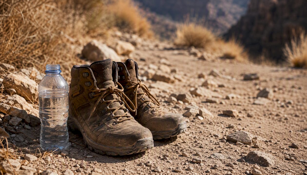
Monsoon season (roughly July through September) brings afternoon thunderstorms that can arrive fast. NPS guidance recommends morning starts specifically to avoid being on the exposed trail when storms roll in. If you see lightning or hear thunder, exit the canyon immediately.
Pack list:
- Water: at least 1 liter per person for a 1-hour hike at altitude; more in summer
- Sturdy, closed-toe shoes with grip (the concrete stairs can be slick when wet)
- Sun protection: hat, sunscreen, sunglasses
- Light layers (the canyon is cooler than the rim, but the climb back up generates heat)
- Small snack for energy on the ascent
- Basic first aid kit
Pro Tip: The ascent out of the canyon is where most visitors hit a wall. Take it in short segments, pausing at stair landings. The elevation change matters more than the distance. Focus on the 185-foot climb when assessing your readiness, not just the trail's short mileage.
Published step counts vary across sources, with figures ranging from around 240 to higher tallies depending on how inclined segments are counted. Don't fixate on a specific number. The elevation change is the more reliable gauge of effort.
Who were the Sinagua, and why does this site matter?
The Sinagua people occupied Walnut Canyon from approximately 1100 to 1250 CE, building more than 80 cliff-dwelling rooms into the limestone alcoves carved by the canyon's seasonal stream. The 25 rooms visible from the Island Trail represent only a portion of the total site, which spans both canyon walls.
What makes Walnut Canyon unusual among Southwestern archaeological sites is how accessible the dwellings are. You walk at the same level as the rooms, not below them looking up. That proximity makes the scale of Sinagua construction immediately legible.
The visitor center film and interpretive signs along the trail provide context that transforms the walk from a stair workout into something genuinely moving. Watch the film first.
Why preservation rules matter here:
- Human oils from touching stone and mortar accelerate deterioration.
- Foot traffic off the designated path compacts soil and damages subsurface archaeological deposits.
- The site is protected under the National Historic Preservation Act and the Archaeological Resources Protection Act.
Staying on the trail and keeping hands off the walls isn't just etiquette. It's the reason these rooms are still standing.
Rim Trail vs. Island Trail: which one is right for you?
The short answer: if you want close-up cliff dwellings and can handle stairs at altitude, take the Island Trail. If you want canyon overlook views with minimal exertion, take the Rim Trail.
Quick comparison:
- Island Trail: ~0.9–1.0 mile round-trip, strenuous, ~185 ft elevation change, ~240 steps, passes 25 cliff-dwelling rooms, entry closes 4:00 p.m., not wheelchair accessible
- Rim Trail: 0.7 mile round-trip, easy, minimal elevation change, paved and partially accessible to first overlook, begin by 4:30 p.m., canyon overlook views without descending
Many visitors do both, starting with the Island Trail while energy is fresh, then walking the Rim Trail before leaving. If you only have 45 minutes, the Rim Trail is the better fit. If you have 90 minutes and solid footwear, the Island Trail is the reason most people drive out here.
How should you behave on the trail to protect the site?
The rules are simple, and each one has a real reason behind it.
- Stay on the designated trail. Leaving the path damages subsurface archaeological deposits that are invisible from above.
- Don't touch the cliff-dwelling walls. Skin oils and repeated contact erode mortar that has survived 800 years.
- No climbing on or into dwelling structures. The rooms are fragile and the drop below them is significant.
- Pack out everything you bring in. There are no trash cans on the trail itself.
- Keep voices low near the dwellings. It's a cultural site, not a theme park.
Leave No Trace principles apply fully here, with the added layer that archaeological resources are irreplaceable. A damaged ruin cannot be restored to its original state.
Pro Tip: Instead of photographing every room quickly and moving on, pick one alcove and spend five minutes really looking at it. Notice the ceiling soot from cooking fires. Notice the hand-placed stones. That kind of attention is what makes the visit stick.
Where to check conditions before your visit
Conditions, hours, and fees can change. Verify these before you leave:
- NPS Plan Your Visit page: Nps — current hours, fees, alerts, and holiday closures
- Visitor center phone: Call the monument directly for real-time winter or storm-related trail conditions; the number is listed on the NPS plan-your-visit page above
- In winter or after monsoon storms, call ahead before making the drive. Trail closures for ice or debris can happen with little advance notice online.
Why the Island Trail belongs on every Northern Arizona itinerary
The Island Trail is one of those rare places where the physical experience and the historical one reinforce each other. The descent into the canyon isn't incidental to seeing the cliff dwellings. It's the point. You arrive at the dwellings slightly winded, at the same elevation the Sinagua chose to build, and the scale of their decision to live here becomes visceral in a way no photograph conveys.
For guests planning a broader Northern Arizona day, Walnut Canyon pairs naturally with Wupatki National Monument to the north, creating a half-day archaeological loop that covers two distinct Sinagua-era sites. Add a scenic drive through the San Francisco Peaks and you have a full day that most visitors to Flagstaff never piece together on their own.
Private guided tours that include archaeological monuments
For visitors who'd rather have logistics handled, Grandcanyonjourneys offers private Northern Arizona tours that can incorporate archaeological monuments like Walnut Canyon and Wupatki alongside Grand Canyon visits. Every tour runs in a premium, climate-controlled vehicle with a WFR-certified guide who handles park entries, routing, and timing so you're never racing a 4:00 p.m. cutoff.

The difference from a self-guided visit is straightforward: you get door-to-door pickup from Sedona or Flagstaff, an expert who can contextualize what you're seeing at each site, and an itinerary built around your pace rather than a bus schedule. For a full overview of private Northern Arizona experiences, visit Grandcanyonjourneys to see current tour options and check availability.
Authoritative links for trip planning
- Plan Your Visit — Walnut Canyon NPS: hours, fees, alerts, and visitor-center details
- Things To Do — Walnut Canyon NPS: both trails described with NPS recommendations
- Grandcanyonjourneys — private Northern Arizona tours: planning resource for visitors considering a guided option
Sources
- Things To Do - Walnut Canyon National Monument (U.S. National Park Service)
- Walnut Canyon Island Trail, Arizona - AllTrails