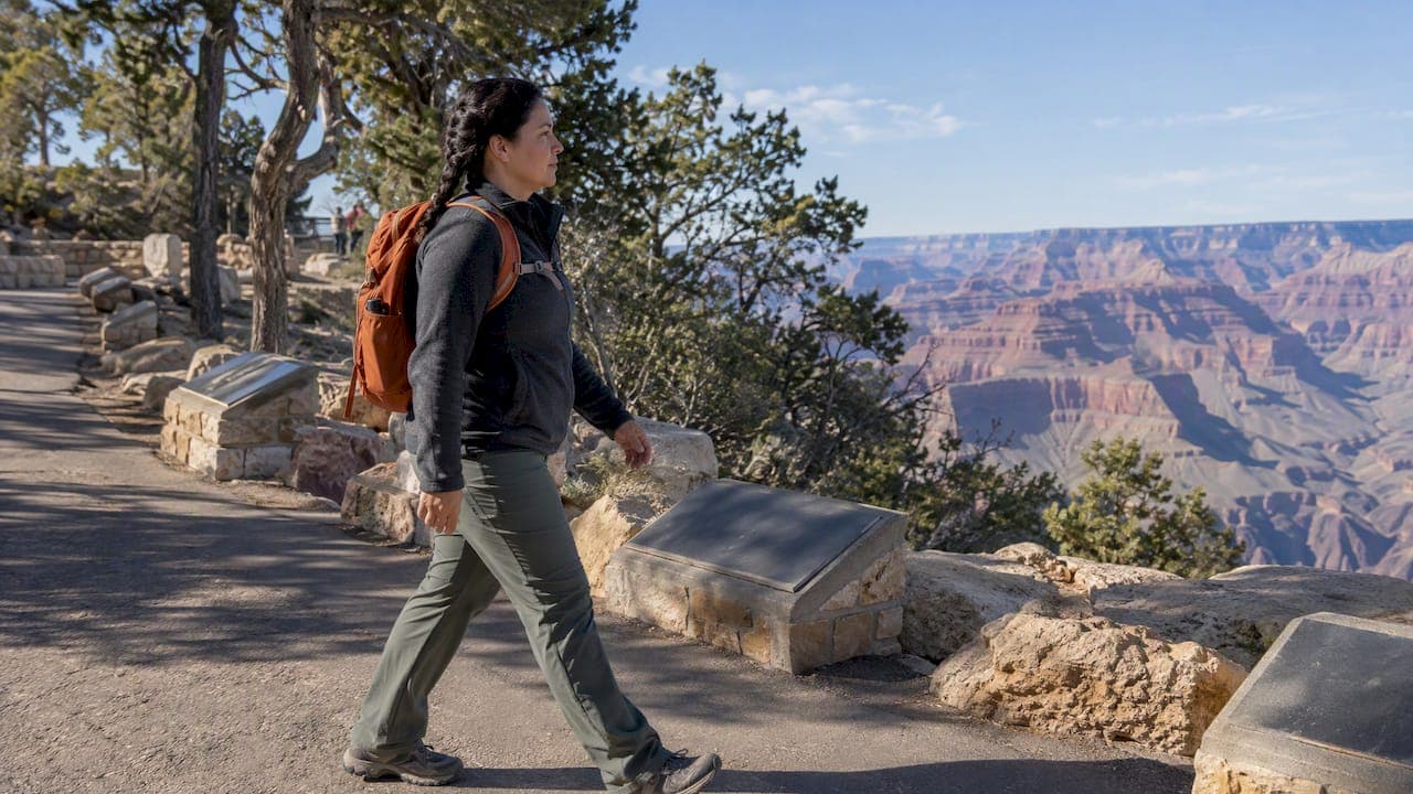
The safest beginner hikes at Grand Canyon are rim walks, not inner-canyon trails: the Rim Trail, the Trail of Time, Shoshone Point, a short out-and-back on Bright Angel Trail, and the first stretch of South Kaibab Trail to Ooh Aah Point. North Rim access stays limited through 2026, so plan around the South Rim and avoid hiking between 10 a.m. and 4 p.m. in summer, since the climb back out always takes longer than the walk down.
TL;DR:
- Most beginner-friendly hikes are rim walks like the Rim Trail and Trail of Time, which are flat, accessible, and suitable for all ages.
- Avoid hiking between 10 a.m. and 4 p.m. in summer due to high temperatures, and always carry more water and salty snacks than you think you'll need.
- Turn back if temperatures exceed 90°F, if you are breathing heavily, or if you have not reached your planned destination by your set turnaround time.
- Short below-the-rim hikes like the first tunnel on Bright Angel Trail or Ooh Aah Point on South Kaibab are suitable for beginners, but lack shade and water.
- Use guided tours or set a strict pace and turnaround times to ensure safety, especially during hot months and for less experienced hikers.
Table of Contents
- 1. The best easy hikes on the South Rim
- 2. How to prepare: Hike Smart rules, altitude, and heat
- 3. Short below-the-rim options and when to turn around
- 4. Two beginner day-hike plans worth trying
- 5. A pace that respects the canyon beats a pace that chases mileage
- 6. How a private guided tour takes the guesswork out of hiking
- FAQ
- Sources
1. The best easy hikes on the South Rim
The National Park Service is direct about this: there is no truly easy trail into or out of the canyon. What qualifies as easy at Grand Canyon is almost always a rim walk, and the South Rim has several genuinely good ones.
The Rim Trail is the backbone of easy hiking here. It runs roughly 13 miles along the South Rim, and much of it is paved and accessible, with shuttle stops along the way so you never have to retrace your steps. The segment from Mather Point to Yavapai Point is flat and well-trafficked, good for a first look at the canyon. The stretch from Verkamp's Visitor Center to Kolb Studio in Grand Canyon Village is shorter and puts you near shops and food. One catch: there is no water west of Bright Angel Lodge, so fill bottles before you head that direction.
The Trail of Time runs parallel to part of the Rim Trail near the visitor center, with markers that lay out the canyon's geologic history at a walking pace. It is flat, short, and especially good for families who want a slow, photo-friendly stroll rather than a workout.
Shoshone Point is the quiet alternative most visitors never find. It is a 2.1-mile out-and-back on a dirt road off Desert View Drive, ending at a point with sweeping views and picnic tables, with almost none of the crowd you get near the main village.

A short out-and-back on Bright Angel Trail works well if you want a taste of hiking below the rim without committing to a real descent. Walking the first half mile to one mile and turning around keeps you on manageable terrain while still giving you canyon walls on both sides.
South Kaibab Trail to Ooh Aah Point is steeper and more exposed than Bright Angel, but the views arrive fast, within the first mile. There is no shade and no water anywhere on this trail, so it suits cooler mornings more than any other time of day.
The Hermit Road shuttle also opens up a run of viewpoint walks between Mohave Point and Hopi Point. You never have to double back, since you can hop the shuttle at any stop, making it one of the easiest ways to string together canyon views without real trail navigation.
- Rim Trail (Mather to Yavapai): flat, paved, about 30 to 45 minutes one way, shuttle access, no water concerns near the village.
- Trail of Time: flat, roughly 20 to 30 minutes, best light in morning for photos.
- Shoshone Point: 2.1 miles round trip, dirt road, quiet, picnic tables at the end.
- Bright Angel short out-and-back: 0.5 to 1.0 mile each way, below-rim terrain, no technical skill required.
- South Kaibab to Ooh Aah Point: about 1.8 miles round trip, steep grade, no shade or water.
Nearly 300 rescues happen at Grand Canyon every year, and most involve heat illness or hikers who misjudged how long the climb back would take. That single fact should shape every route choice on this list.
2. How to prepare: Hike Smart rules, altitude, and heat
The park's own Hike Smart guidance boils down to a few rules that matter more than fitness level. Follow them and most of the risk disappears.
- Avoid hiking between 10 a.m. and 4 p.m. during the hotter months, when canyon temperatures routinely climb past 100°F.
- Carry more water than you think you need, and pair it with salty snacks to replace what you sweat out.
- Let the slowest person in your group set the pace, not the fastest.
- Plan your turnaround time before you start, and stick to it even if you feel strong.
The South Rim sits around 7,000 feet, high enough that some visitors notice shortness of breath or light-headedness even on flat trails. Give yourself a few minutes to adjust before pushing into anything strenuous, and treat dizziness or nausea as a reason to stop, not push through.
Ascent always takes longer than descent, often twice as long, so if the walk down a trail takes 20 minutes, expect closer to 40 minutes back up in full sun. Winter brings ice on the rim, especially in shaded sections, while summer brings both heat and the chance of monsoon lightning on exposed viewpoints. North Rim services remain limited through 2026 following storm and fire recovery, with some areas missing potable water entirely, which is one more reason South Rim trails are the better bet for a first visit.
Tell someone your planned route and return time before you set out. Bright Angel Trail has emergency phones at intervals along the corridor, a detail worth knowing if you are hiking with kids or older relatives.
Pro Tip: Set your turnaround time by the clock, not by how you feel, since fatigue and heat both cloud judgment on the way back up.
3. Short below-the-rim options and when to turn around
If rim walks feel too tame, a handful of short below-rim stretches let you dip a toe in without real risk, as long as you respect the distances.
On Bright Angel Trail, the first tunnel sits well within the first half mile, an easy marker for a short there-and-back. The Mile-and-a-Half Resthouse sits exactly 1.5 miles down, making a 3-mile round trip with a real elevation change, enough to feel like a hike without being risky for a reasonably fit adult. Three-Mile Resthouse, at 3.0 miles down, is a 6-mile round trip better suited to experienced day hikers, not first-timers.
South Kaibab's run to Ooh Aah Point is a good single-vision alternative. It is short, the views arrive almost immediately, and it avoids the crowding that builds up on Bright Angel. The tradeoff is exposure: no shade, no water, and a steeper grade the entire way.
- Turn back if it is past 10 a.m. and you have not reached your planned destination yet.
- Turn back if canyon temperatures are already climbing past 90°F at the resthouse.
- Turn back if anyone in your group is breathing hard, sweating heavily, or slowing down significantly on the way out.
For a closer look at how these two corridor trails compare, our guide on South Kaibab versus Bright Angel breaks down which one fits different skill levels, and our Bright Angel day hike guide covers timing in more detail.
4. Two beginner day-hike plans worth trying
Plan A, the rim morning loop: catch an early shuttle to Mather Point, walk the paved Rim Trail to Yavapai Point, stop at the geology museum, then continue to the Trail of Time for a slow, educational finish. Cooler morning light makes the whole loop more comfortable and the photos better.

Plan B, the Bright Angel test drive: start at first light, walk down to the Mile-and-a-Half Resthouse, rest, refill water if available, and turn around no later than your preset cutoff time. Shuttle back to your vehicle or lodging once you are back on the rim.
Some beginners prefer to skip the planning entirely and let a local guide handle timing, pacing, and trail choice. For details on route logistics and shuttle planning, our shuttle routes guide and hiking guide cover both independent and guided approaches.
5. A pace that respects the canyon beats a pace that chases mileage
The canyon rewards patience more than ambition. Conservative pacing, turning around before you're tired rather than after, consistently produces better hikes than pushing for one more viewpoint. I've watched a group abandon a below-rim walk halfway down because the heat had crept up faster than expected, and it was the right call: no view is worth a rescue call. Check the park's current trail status before you go, since conditions shift season to season and year to year.
— Chris
6. How a private guided tour takes the guesswork out of hiking
Planning the timing, water stops, and turnaround points on your own takes effort, and that's exactly where a guide earns their keep. Some private tour operators offer day tours with door-to-door pickup from local towns, so your day can start without a parking search or a shuttle schedule to track.
A local guide manages pacing, picks the right rim sections for the group's fitness level, and makes the call on turning back before heat becomes a problem. For travelers who want a short guided descent below the rim instead of a solo attempt, the Grand Canyon Hiking Tour is built around exactly that kind of beginner-friendly pacing. You can check available dates and start planning your pickup location directly from that page.
FAQ
What counts as an easy hike at Grand Canyon?
An easy Grand Canyon hike generally means a rim walk, like the Rim Trail or Trail of Time, rather than any trail that descends into the canyon. The National Park Service notes that no inner-canyon trail is truly easy, since even short descents involve a strenuous climb back out.
What is the top predator in the Grand Canyon?
The mountain lion is generally considered the canyon's top predator, though sightings are rare for most visitors. Hikers are far more likely to encounter mule deer, elk, or California condors along popular trails.
How many people fall from Grand Canyon every year?
The park does not publish an exact annual fall count in its public hiking guidance, but it does report that more than 300 rescues occur each year, many tied to heat illness or hikers misjudging the return climb. Staying on marked trails and away from unprotected edges remains the best way to avoid becoming part of that statistic.
Are there grizzly bears in the Grand Canyon?
No, grizzly bears do not live in the Grand Canyon region. Black bears are occasionally present at higher, forested elevations near the rim, but encounters on popular day hikes are uncommon.
What is a beginner-friendly hiking trail at Grand Canyon?
A beginner-friendly trail at Grand Canyon is a flat, paved, or well-maintained rim route such as the Rim Trail, Trail of Time, or Shoshone Point, all of which avoid the steep grades of inner-canyon trails. These routes let new hikers enjoy canyon views without the ascent risk that comes with trails like Bright Angel or South Kaibab.