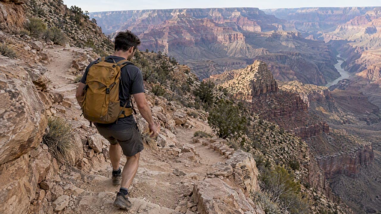
The best South Kaibab day hike is a short one. Walk down to Ooh Aah Point, Cedar Ridge or, if you are fit and the weather is cool, Skeleton Point, then turn around while you still feel fresh. Start early, carry far more water than seems reasonable, take the shuttle to the trailhead, and treat the climb back up as the real hike. Below, we cover each of those decisions in detail.
TL;DR
- Pick a turnaround before you leave: Ooh Aah Point (1.8 miles round trip), Cedar Ridge (3 miles) or Skeleton Point (6 miles). The park service advises against going farther in a day.
- There is no water on the trail. Fill up at the trailhead and carry enough for the whole round trip, at least 4 liters in hot weather.
- You cannot park at the trailhead. Use the park shuttle.
- Rim to river and back in one day is the mistake rangers warn about most. Turning around early is the skill that matters.
- Check the park's closure alerts the day you hike. Parts of the inner canyon were closed after the August 2026 flash flood.
Table of Contents
- Check what is open before anything else
- Pick your turnaround point first
- Why "the easy part" is the trap
- Rim to river in a day: what to do instead
- Water, food and gear
- Getting to the trailhead
- Timing: when to start and when to avoid it
- Trail etiquette that keeps everyone safe
- Our perspective: why we send guests down smart, not far
- A guided alternative if you would rather not plan it all
- A sample morning on South Kaibab
- FAQ
- Sources
Check what is open before anything else
This year the trail itself changed. After the August 29 flash flood, the National Park Service closed the South Kaibab Trail below the Tip-Off, along with other inner-canyon areas, and KNAU reported that no reopening date had been given. That does not affect the day-hike turnarounds below, because Ooh Aah Point, Cedar Ridge and Skeleton Point all sit above the Tip-Off. It does mean the river is off the table for now. Conditions change, so look at the park's current closures page on the morning you hike, not at a printed guide.
Pick your turnaround point first
The park service lists three destinations that make sense for a day hike:
| Turnaround | Round trip | Typical time | Elevation change |
|---|---|---|---|
| Ooh Aah Point | 1.8 miles | 1 to 2 hours | 790 feet |
| Cedar Ridge | 3 miles | 2 to 4 hours | 1,120 feet |
| Skeleton Point | 6 miles | 4 to 6 hours | 2,040 feet |
The park's guidance says to check with a ranger before attempting Skeleton Point as a day hike, and that hiking below it is not recommended because of the distance, the temperature swings and roughly 5,000 feet of elevation change each way.
Which one is right for you
Ooh Aah Point is the first big payoff. The trail drops through a set of switchbacks and opens onto wide views in both directions. It suits families, anyone new to canyon hiking, and a morning with a flight later. You get the ridgeline feeling for under two miles.
Cedar Ridge adds a flat, open rest area and a longer stretch of the ridge. It is the best choice for most visitors who want a real hike without committing to a full day. There is a toilet here, but no water.
Skeleton Point is for people who hike regularly, are used to steep terrain, and are visiting when it is cool. It looks across to the river. Treat it as a ceiling, not a target.
The number worth remembering: the climb back up generally takes about twice as long as the descent, as the Grand Canyon tourism board notes. If you spend two hours walking down to Skeleton Point, plan on four hours coming out.

Why "the easy part" is the trap
Every first-time canyon hiker has the same experience. The first hour feels almost too easy. The views are enormous, your legs feel strong, and a few more switchbacks seem harmless. This is the canyon in reverse: the effort comes at the end, when you are tired, the sun is higher and the walls hold heat.
That is why a simple rule works better than any fitness plan. Decide your turnaround time, not just your turnaround place. If you plan to be back at the rim by noon, start up by 9 a.m. at the latest, even if you are two switchbacks from your goal. Turning around while you still feel good is the single most useful decision you will make, and it is one that rangers repeat constantly.
Rim to river in a day: what to do instead
People search for a rim-to-river day hike because the Colorado River looks close from Yaki Point. It is not. The park service strongly discourages hiking from the rim to the river and back in one day, particularly in the warmer months, because of the roughly 5,000 feet of elevation change each way and the heat. The park also reports hundreds of rescues each year, many involving day hikers who underestimated the climb.
If the river is your goal, there are better ways to approach it:
- Spend a night below the rim. This needs a backcountry or lodging reservation, which is booked well ahead and, at the moment, limited by the closures.
- Go down South Kaibab and up Bright Angel over more than one day. Bright Angel has seasonal water and a ranger station, which South Kaibab lacks. Our comparison of South Kaibab and Bright Angel explains the trade-offs.
- See the river from above. Several South Rim viewpoints show it, and a short hike to Ooh Aah Point or Cedar Ridge gives a feel for the descent without the risk.
If you are choosing between the two corridor trails for a shorter hike, the same logic holds. South Kaibab gives you the views and the shortest route to the inner canyon. Bright Angel gives you shade and water points. Our Bright Angel day hike guide covers routes and timing for that trail.
Water, food and gear
There is no water anywhere along South Kaibab. The park's trail sheet says there is a spigot at the trailhead, but that is for filling up, not for relying on during the hike. For hot weather it recommends carrying at least 4 liters and a way to treat water if you plan to use other sources, since even official water systems can fail when pipelines break.
For a half-day hike to Cedar Ridge in cooler months, you will not need that much, but you should still carry more than you expect to drink. Our packing list:
- Water: a full reservoir or bottles, plus one extra. Freezing one bottle the night before keeps it cold for the first hours.
- Salty food: pretzels, nuts, jerky or electrolyte chews. Water alone is not enough on a steep climb in the heat.
- Footwear: trail shoes or boots with real tread. The trail is dirt, steep and sometimes loose.
- Trekking poles: they take pressure off your knees on the descent and your legs on the climb.
- Sun protection: a brimmed hat, sunglasses and sunscreen. There is very little shade, and the park describes it as coming mostly from the canyon walls early in the day.
- Layers: the temperature gap between the rim and the inner canyon can be dramatic. Reports on canyon crossings describe differences of as much as 60 degrees over a single day.
- Headlamp: only if you will hike near dawn or dusk.
The park's own hiking FAQ makes a point that applies to every item above: attitude, food and water decide whether a canyon hike goes well, especially in summer.
Getting to the trailhead
You cannot park at the South Kaibab trailhead, which sits near Yaki Point. Hikers use the park shuttles instead: the Hiker Express from Bright Angel Lodge or the Kaibab Rim (Orange) route from the Visitor Center. Early shuttles are the best choice, and you want to be on the first one that fits your plan. Schedules change by season, so confirm them before your trip with our South Rim shuttle routes guide.
Plan the logistics backward from your return. Know when the last shuttle leaves the trailhead area, and leave yourself a margin.
Timing: when to start and when to avoid it
Start at first light. The first hour of the day has the best temperatures, the softest light for photography, and the thinnest crowds. By late morning the open ridge is exposed and the trail gets busy.
Summer needs a different plan. From late spring through early fall, the inner canyon can be dangerously hot while the rim feels pleasant. Our guide to summer safety at the Grand Canyon and our article on heat index rules for hiking in Arizona explain how to decide when to hike and when to skip it. In peak summer, many experienced hikers go only as far as Ooh Aah Point at sunrise and are back on the rim before it warms.
Winter and shoulder seasons are friendlier. The park notes that constant sun exposure tends to keep most of South Kaibab free of ice and snow in winter, but the upper switchbacks can still be slick, so ask at the visitor center about traction.
Trail etiquette that keeps everyone safe
Two rules matter above the rest.
- Uphill hikers have the right of way. Step aside and let them pass, since they face the harder effort. When you are the one climbing, a short pause to catch your breath is also a good time to let others go by.
- Mule trains: the park's guidance is to step off on the uphill side of the trail, stay quiet and stand still, and follow the wrangler's directions, until the last mule has passed. The park's hiking FAQ has the detail.
Also stay on the trail, do not feed wildlife, and keep your group together. Stopping for photos on a narrow ridge is fine; stopping in the middle of the path is not.
Our perspective: why we send guests down smart, not far
We are a locally owned Northern Arizona operator, and we get one question again and again from guests planning a hiking day: how far can we go? Our answer is almost never "as far as possible."
The canyon rewards good judgment more than good fitness. Guests who treat Ooh Aah Point or Cedar Ridge as a complete, satisfying hike come back to the rim relaxed and delighted. The ones who push for the river often come back with an unhappy story. The views from the upper trail are among the best in the park, so there is rarely a reason to risk the rest.
What makes the difference on the day is logistics: when you start, how much water you carry, how you reach the trailhead, what the weather will do and what the closure alerts say. That is why we handle these details for our guests. With a private tour, the pace is set by you, not by a schedule built for a crowd. If you would rather think about the views than the shuttle timetable, that is what a local guide is for.
If you are comparing South Kaibab with Bright Angel, the rule we give guests is simple: choose South Kaibab for views and short hikes, and choose Bright Angel when you want shade and water. Neither trail is a sensible out-and-back to the river in a day.
— Chris
A guided alternative if you would rather not plan it all
If you want a hike below the rim without managing shuttles, water and timing yourself, our private Grand Canyon hiking tour is built for that. It is a private, guided experience with door-to-door transportation in a luxury vehicle, an expert local guide, and park fees and dining included. It starts from $349 per person. Staying in Sedona? See our Grand Canyon tours from Sedona. If a full day on the trail is not your plan, our private Grand Canyon day tour, from $319 per person, is a gentler way to see the rim.
If you are still deciding how many days to give the park, our South Rim itinerary and Grand Canyon travel planner lay out the options.
A sample morning on South Kaibab
This is how a well-judged cool-season hike to Cedar Ridge might run.
- The night before: fill and freeze one water bottle, lay out layers, and check the park's closure page and shuttle times.
- Early morning: take the first shuttle that suits your plan to the trailhead. Top up water at the spigot.
- First hour: walk down the switchbacks slowly. Stop at Ooh Aah Point for photos. Eat a snack before you feel hungry.
- Cedar Ridge: rest in the flat open area, drink, eat and check the time. Decide here whether you are turning around, and then turn around.
- The climb: go slowly, take small breaks in any shade the walls give, and yield to others as the trail demands. Expect the climb to take about twice as long as the descent.
- Back on the rim: finish with a meal and extra water. Dehydration often shows up after the hike, not during it.
For more trail options and general planning, our Grand Canyon hiking guide is the next stop.
FAQ
Is Bright Angel or South Kaibab harder?
South Kaibab is steeper and shorter to any given point, with no water and little shade. Bright Angel is longer but has more shade and seasonal water, so many hikers find it easier to climb out of. For a short out-and-back hike, South Kaibab's views are hard to beat, but only in good conditions.
Can you hike to the river and back from South Kaibab in one day?
The park service strongly advises against it, especially in warm months, because of roughly 5,000 feet of elevation change each way and the heat. The trail is also currently closed below the Tip-Off after the August 2026 flash flood. Choose a turnaround at Ooh Aah Point, Cedar Ridge or Skeleton Point instead.
Can I park at the South Kaibab trailhead?
No. Parking is not permitted at the trailhead. You reach it by the Hiker Express shuttle from Bright Angel Lodge or the Kaibab Rim (Orange) shuttle from the Visitor Center.
How much water should I bring?
There is no water on the trail itself. In hot weather the park recommends at least 4 liters, and in cooler weather you should still carry more than you expect to drink. Fill up at the trailhead spigot before you start.
What is the most important etiquette rule?
Give the right of way to uphill hikers. If you meet a mule train, step off on the uphill side, stay quiet and still, and wait until the last mule has passed.
Sources
- National Park Service: South Kaibab Trail destinations and distances
- National Park Service: South Kaibab Trail trailhead access and water
- National Park Service: Day Hike, South Kaibab Trail
- National Park Service: Hiking Frequently Asked Questions
- National Park Service: Inner canyon closures following the August 29 flash flood
- KNAU: Grand Canyon National Park expands list of trail closures
- Visit Grand Canyon: Best hikes and trails
- KSL: Rim-to-rim trek across the Grand Canyon